False Cartographies
LOCATION //
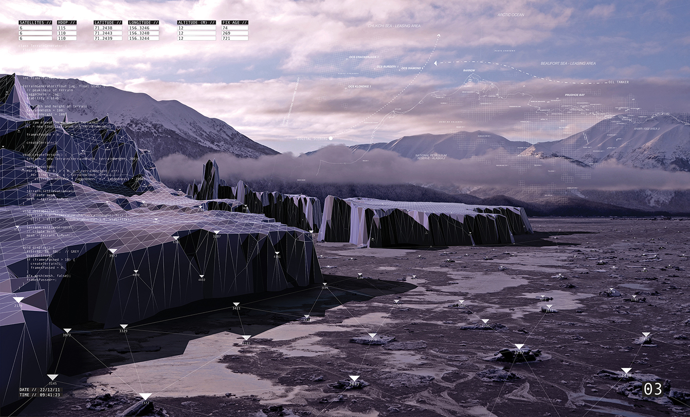
Alaska // Barrow
HERE BE DRAGONS: THE UNSTABLE LANDSCAPES OF GPS from Will Gowland on Vimeo.
DESCRIPTION //
The world is now concealed and manipulated in ways that make answering the question of where am I an impossibility. Glitches in the big and fragile infrastructures of Global Positioning systems mean we are sometimes both here and there, as a pulsing blue dot locates us to within 500 meters. What are the implications of a navigational system based solely on the virtual?
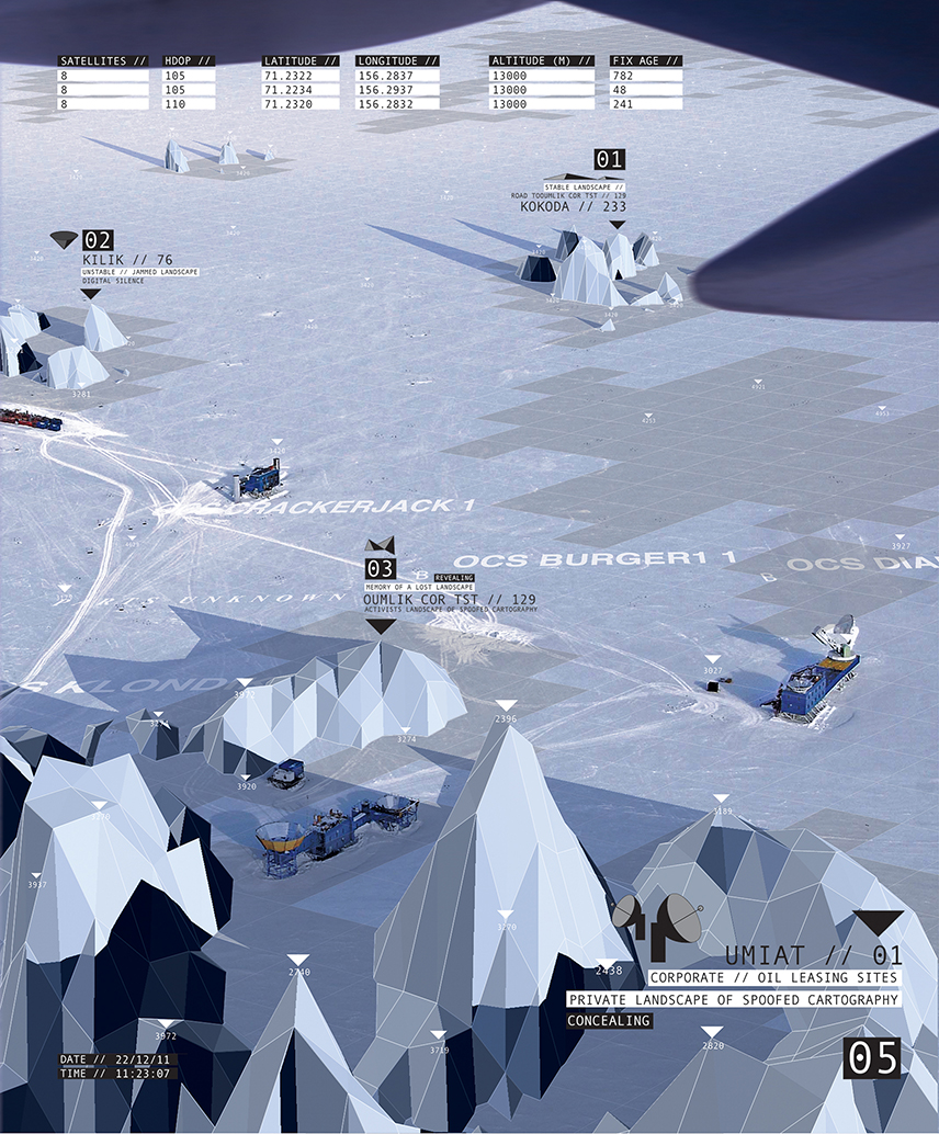
Through jamming the GPS network, an alternative virtual topography is revealed as a territorial architecture of spoofed cartography; Emerging as a landscape that operates and exits in two parallel worlds, the physical and the virtual.
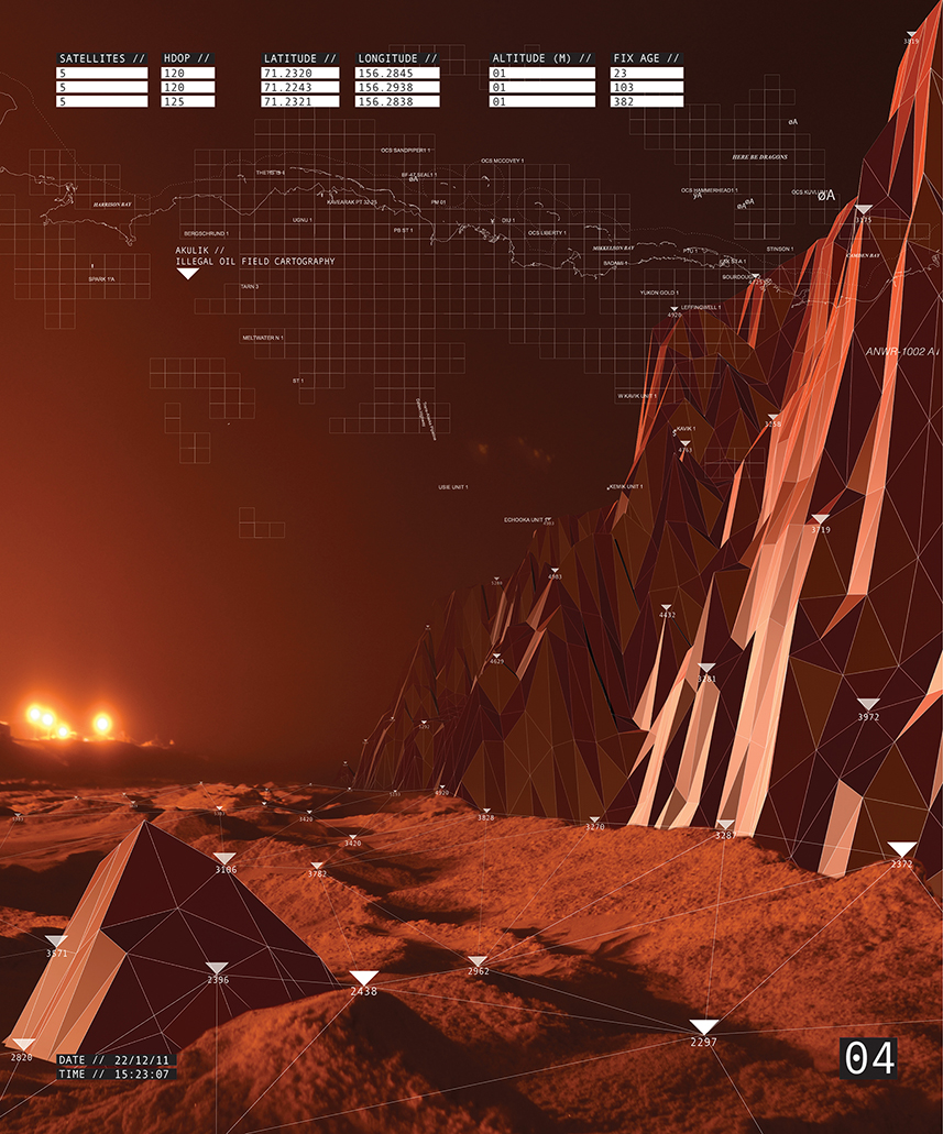
Imaginary protest icebergs drift through the autonomously navigated oil shipping lanes. We get lost in a wilderness of illegal signal jamming formations and we glimpse the faint flicker of covert militarised GPS territories, super stable under a secret sky of black satellites.
Some are landscapes of misdirection, others are navigational markers guiding one safely through unstable terrain. We now put our faith in a digital territory that is just as unknown and fallible as the physical.

UNSTABLE LANDSCAPES // GPS LIVE LANDSCAPE DEMO from Will Gowland on Vimeo.
LIVE LANDSCAPE //
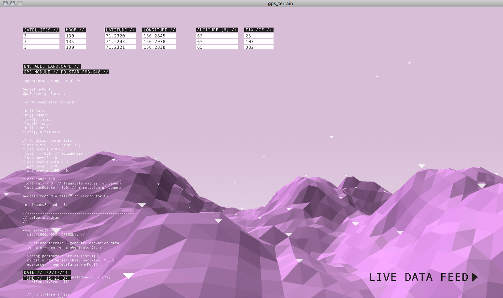
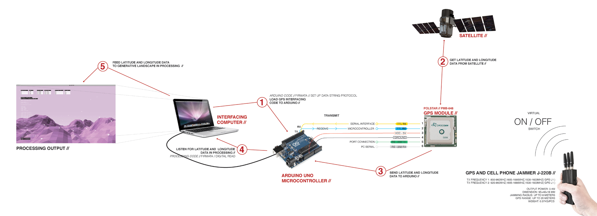
This live landscape is fed off live data through a gps receiver that is generating a topography that reflects the stability and reliability of the data it receives. Giving rise to the idea that one can learn to read this data like the weather.
The number of satellites connected feeds the stability - The rate at which the landscapes appears to flicker. The more satellites that are connected the less it flickers appearing calm. With fewer satellites connected the landscape oscillates more.
The HDOP is an accuracy reading and is feeding the jaggedness of the landscape.Which is defined by the satellites azimuth angle. If the satellite is low to the horizon, atmospheric interference is high leading to less reliable data. The lower the HDOP the more accurate the data and the landscape appears flat. The higher the HDOP and the less accurate the data, the landscape appears jagged and mountainous.
The latitude and longitude effects the cameras global position by moving about the landscape. With the gps receiver sat in one location the camera will not move. Although it is still possible to pan from this fixed position as demonstrated. The fix age is causing the volume of the beep you are hearing to change, getting louder and quieter depending on the length of time it takes for the signal to be sent from the satellite to the receiver.
The background soundscape is the sound of Kosmo 736 a Russian Reconnaissance satellite from the 70’s slowed down to 700%
The satellites onboard clock affects global illuminations so that the landscape follows night and day cycles.
The landscape can therefore be controlled by a device such as a GPS jammer. Allowing individuals to control this landscape at their leisure.
AWARDS //
Baylight Scholarship: Full fee scholarship // Architectural Association.
Architectural Journals 'Stand Out Student' of the Architectural Associations Summer Exhibition - "William Gowland of Diploma Unit 6 for his poetic commentary on GPS’ impact on the politics of the arctic wilderness titled: Here be Dragons" //